Hiking Utah's Tallest Peak

Hiking Kings Peak, the tallest mountain in Utah, is a time honored tradition for most outdoor people in Utah. Whether you grew up in the Boy Scouts or your family was into backpacking, Kings Peak is always on everyone's hiking "bucket list".
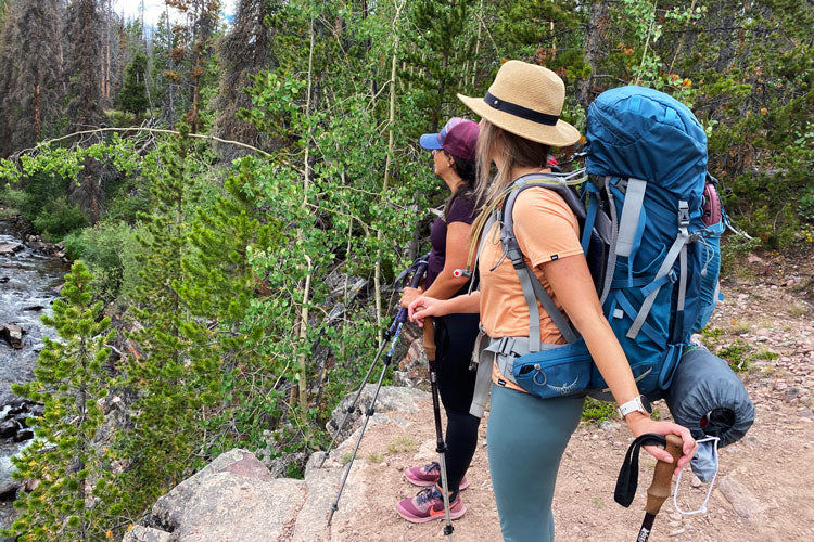
A few weeks ago, a friend of ours was coming into town. Whitney had a long weekend and wanted to hike Kings Peak. My wife and I have been up Kings Peak a few different times and we are always up for an adventure, so we decided to take her up the mountain.
Kings Peak is a unique mountain to climb and has its own set of special challenges. The first is the weather. Kings Peak is located in the Uinta Mountains and the snow doesn't usually melt until late June or early July. This leaves a short hiking window as September or October starts to see snow. Another challenge is the approach to Kings Peak. The hike is 26-30 miles round trip with the summit being 1.5 miles up a rocky boulder field. That means the approach to Kings Peak can be anywhere from 8-13 miles. One of the other challenges is getting to the trail head. There is not a very direct route for those of us in Salt Lake. We have to drive three hours north into Wyoming before dropping back down into Utah. The driving adds a lot of time to the start and finish of the trip.
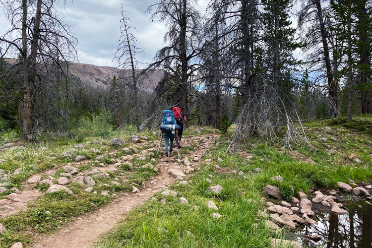
We had talked about doing the hike as a 3-day trip but I have always done it as a 2-day trip. Hike in most of the way to the base of the mountain, camp that night, summit early in the morning, break down camp, and hike out. Easy. But it's never really that easy and your brain is quick to forget what 30 miles in 36 hours feels like on your legs. We decided to do the 2-day trip as I didn't a have a 3-day weekend and I have been very busy at work.
We got up at 5:30am on Saturday morning and got on the road shortly after that. The drive to the Uintas is actually very pretty and at that time virtually no traffic. You drive past Park City and into the plains of Wyoming before heading south towards the Uinta highlands. As you drive south, the Uinta Mountain Range fills the horizon. The Uinta Mountains trend east to west and are a subrange of the Rocky Mountains. They are actually the highest range in the contiguous United States that runs east to west.
We arrived at the Henrys Fork trailhead around 9am. After changing shoes, checking packs, water, and applying sun screen we headed south along the Henrys Fork river. The trail in is not overly difficult and sees a lot of foot and horse traffic. The first five miles is heavily wooded forest and pretty rocky. You cross the river at this point and it opens up into a large valley and you get your first site of Kings Peak off in the distance.
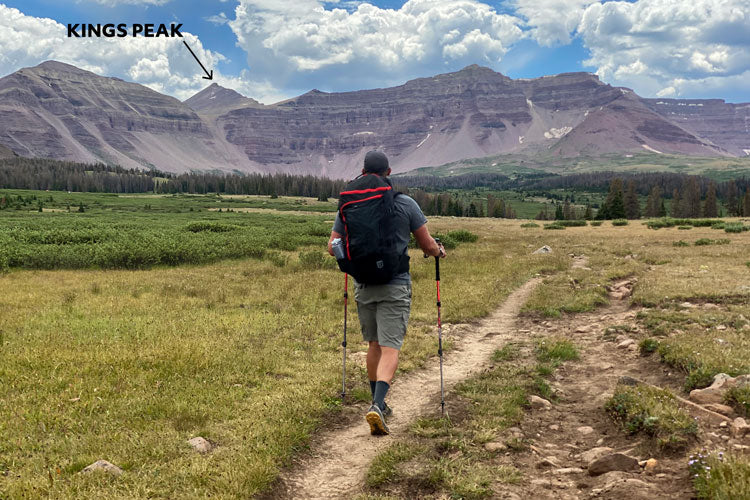
I have been using some of the new Sovereign Redline 50L prototypes for the last year and this was the perfect opportunity for me to put a production model through a "real" backpacking trip. I must admit that I am a bit of a minimalist when it comes to backpacking. I like trying to get my pack as light as possible. I find carrying a lighter pack makes the hike much more enjoyable as you aren't as fatigued and feel relatively good once you arrive at camp. The Sovereign is a 50 liter pack and is about 10 liters larger than I normally carry but it worked out well as I carried the tent for my wife and I, a cook kit for all of us, and all of the other gear that I would be using.
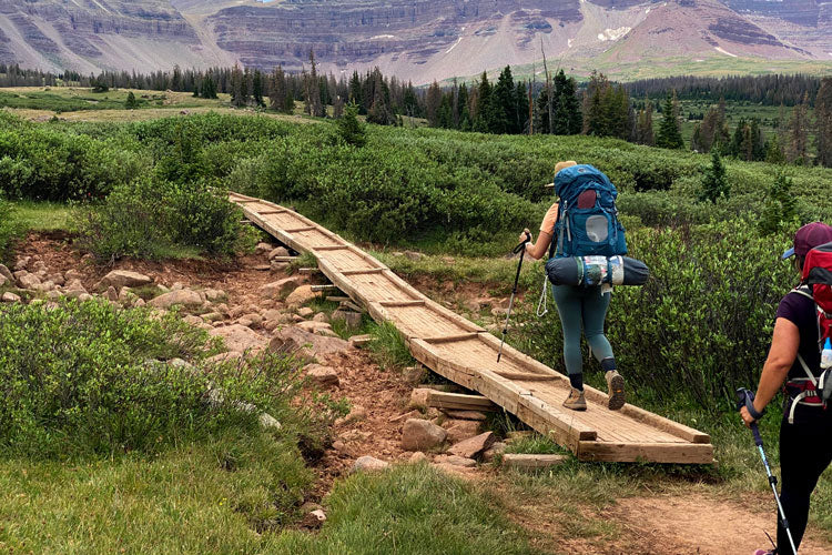
Crossing the valley towards Kings Peak is a highlight for me. It is stunning. There are wild flowers everywhere, dozens of small lakes, and mountain peaks surrounding you. Most people camp around Dollar Lake and for good reason. It is one of the few wooded areas along the trail and Dollar Lake is good for fishing and a good water source. The problem is everyone wants to camp there. I go backpacking and camping to get away from everything and I don't want to feel like I am camping in a KOA in the middle of the Uintas. Plus, if you are doing this hike in two days, camping near or around Dollar Lake makes for a huge second day.

We prefer to hike a few miles further and go over the top of Gunsight Pass and into Painters Basin.
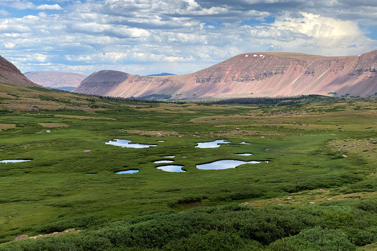
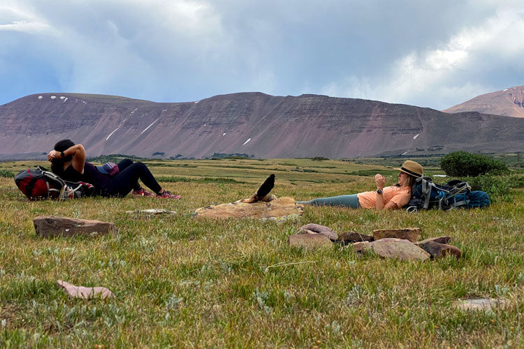
Painters Basin is the perfect name for this large basin below Kings Peak. It is even more beautiful than the valley approach towards Gunsight Pass. It is lush green with dozens of small lakes, tall peaks, and mountains as far as the eye can see. This is where we set up camp for the night. After hiking in 11-12 miles, it feels amazing to get your pack off your back and lie down for a little while.
After setting up our camp, we wandered 3/4 of a mile down the trail to a stream that was flowing pretty good. Here we filtered water to fill up our hydration reservoirs and a few Nalgenes for cooking. I had brought my Versa Flow water filter and the CNOC Vecto 3L water container. This is such a great combo for lightweight backpacking and for small groups. We used my JetBoil to boil water for our dehydrated dinners and shared two cans of Pinot Noir. Whoever invented putting wine in a can is a genius. After cleaning up dinner, we talked for a little while before going to bed.
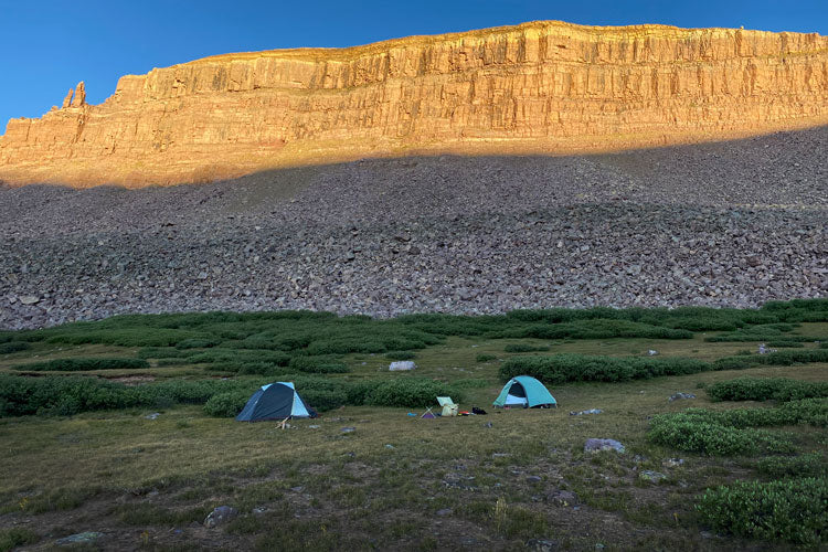
I always get up early when I am camping. Around 6am I decided to get up and make some coffee. I like mornings in the mountains. The sun isn't up yet and everything is still quiet. It is nice to wander around and watch the world begin to wake up.
After breakfast, we packed our day packs and began hiking towards the base of Kings Peak. I brought our new Surge Redline Hydration Backpack for my daypack as I wanted something small for the summit. I was only carrying a 3 liter water reservoir, a puffy jacket, rain jacket, and some snacks. The Surge was really comfortable and perfect for this.
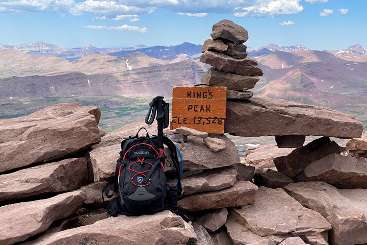
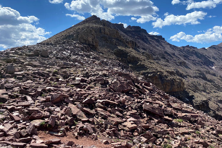
It is only a few miles to the base of the peak and it goes by pretty quick but once you get to the base of Kings Peak, the going gets a little tough. To summit Kings Peak, you have to boulder hop 1.5 miles up the ridge line. There is not a trail and you just have to find a way up. I joke that it is similar to doing 1,000 lunges but in reality, it probably is. It took us about 75 minutes to go that last 1.5 miles to the summit but the views are amazing the entire way up.
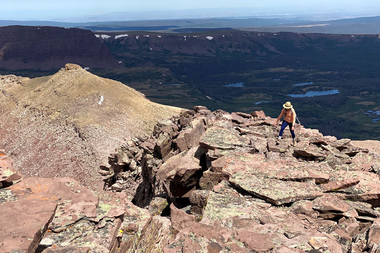
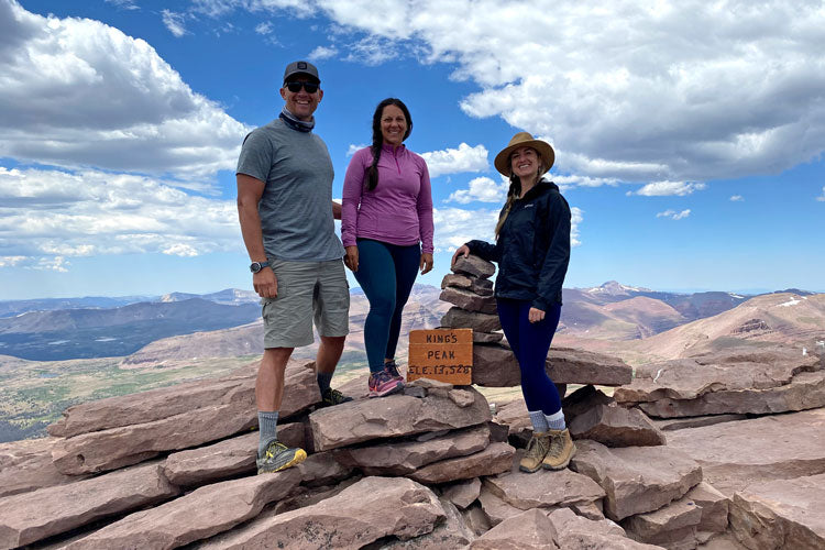
Reaching the summit, we were pleased to find that we had the whole thing to ourselves. Normally, there are half a dozen small groups congregating at the top, eating lunch, taking pictures, etc. We were there for about 10 minutes before another couple showed up. They were nice enough to take a photo of the three of us before we headed back down the mountain.
The day before we had seen some people coming off a steep slope to the right of Gunsight Pass. I had asked them where they were coming from as I have never seen this trail before. They said they had come from the peak and that this was a "newer" shortcut. As I had never been on this shortcut, we decided to take it down. It was pretty rough as you had to scramble over a lot of rock and there wasn't a trail. Coming off the top of the plateau down to Gunsight Pass was a little sketchy. Very steep, lots of loose rock, and not a lot of traction. I understand that it does save some distance but it was pretty rough and I'm not sure it was worth the effort.
Making our way back to camp, we had a quick lunch before breaking down our camp and repacking our bags. On the way up I had the tent inside the Sovereign backpack. I decided to try putting it on the bottom of the pack with the two compression straps that are on the bottom. I was curious to see how the load felt on my back. I have had some packs that do not do well when the load is displaced like this but the Sovereign did great. The tent didn't move and felt very solid. I wouldn't hesitate to keep it on the bottom of the pack in the future and utilize the interior space in other ways.
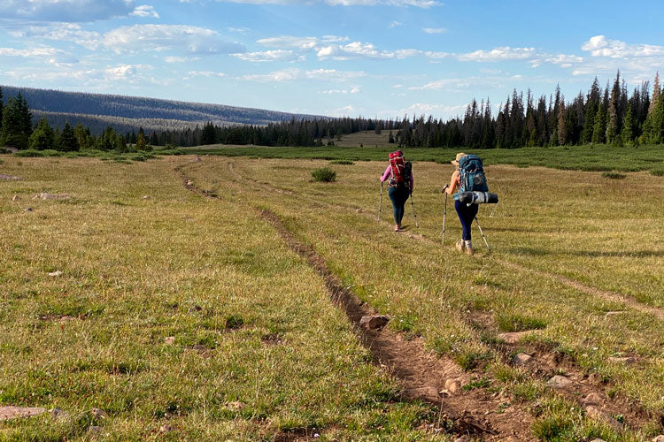
The hike back to the car always seems longer than the hike up. Probably the fatigue setting in and you know you are almost finished. Hiking out on a Sunday was nice because there were very few people on the trail. We stopped one last time at a river crossing to filter more water. It was getting pretty late in the day when we reached the tree line again. I stopped a few times to get some photos of the changing sky and was reminded of what a beautiful area this is.
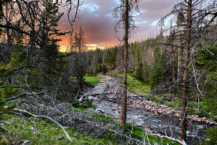
We arrived back at the car just in time to not have to use headlamps. We unloaded our packs, which were feeling very heavy for the last five miles, and swapped out our dusty shoes and socks for some comfortable flip-flops. All in all, the trip was a success and we were happy to share this great backpacking trip with a good friend. Until next time...
ABOUT THE AUTHOR

Kirk is the Marketing Director at 3V Gear and is an active outdoors man. When not working, you will often find him in the Utah mountains biking, hiking, camping, skiing, or trail running. He likes to travel the world with his wife, exploring new cultures and meeting interesting people, all the while photographing everything he sees.


Great stuff Kirk! This is awesome. Planning to do Kings Peak myself next Spring.
Awesome to see those pics and hear the story. I did Kings sometime around 1980 or so with my wife and a buddy. We had gone up Henry’s Fork and decided to go over Gunsight Pass to Painter’s Basin. We spent a day there before we made the decision to climb Kings Peak. This was at the end of a 10 day tre
k. I have a photo showing a plaque on the peak. The funny part was that there was a U.S. mailbox with a notebook where people hand been writing down their experiences. We never could stand for a photo due to a very uncomfortable level of static electricity. It’s evident of this in the photo where my long hair is standing on end. I didn’t see the plaque or the mailbox in your photos. I was just curious if they were still there. That day with all the electricity in the air made it an extra memorable trip. Just glad we didn’t end up being lightning rods. Thanks for the memory of that trip. Keep trekking!
Great hiking story. Makes me want to get out of the shop and do SOMETHING
1
Thanks for posting the story. Love the pics that go with it. Makes me want to get out of the shop and do SOMETHING!!
Leave a comment